

Welcome to an Amargosa Summer
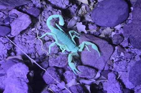
A scorpion under UV light. Photo from Cameron Mayer.
Some might say fall is defined by New England fall leaf color tours. In that light, we submit that summer reaches its apex in the Death Valley region, and especially here in the Amargosa. It’s not for nothing that there are thermometers everywhere, from the iconic roadside one in Baker, to the little thermometer tucked under a pergola next to the gas station in Shoshone. Summer, of course, brings the heat, so the region is a little quiet right now. Those rugged folk who are still around employ a daily routine of making the most of the early mornings, the afternoon siesta, hydration, and mind over matter.
Local plants and animals already know how to survive the summer: animals using holes and tunnels, some plants shutting down fleshier water-losing parts, and migratory species choosing their summer strategy carefully. I like to think that summer in the Amargosa isn’t just a season to grin and bear; it is a spectacular demonstration of nature’s already evolved and built-in resilience.
Friends of the Amargosa Basin – with our all-star collaborators and partners – was built to support this resilient place as it stands fast against accelerating human-caused challenges. We believe that this support is best accomplished with a National Monument, keeping humans deeply embedded in the solution, the vision, and the management.
We – the plants, the animals, and the humans – are building up our strength, so we can poke out of our holes when the time is right and as we really do this thing: we craft the Amargosa Basin National Monument. We invite you to take a little time and just bask in the warmth of the stories below. Stay engaged, stay hydrated, and believe.
Best regards, Janet, on behalf of FAB’s Communications team, and all of us at FAB.
A Fall Geology Rendezvous by Darrel Cowan
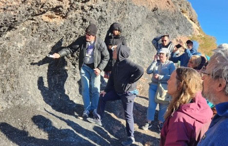
Geologist Darrel Cowan leads a group at the famous Black Stripe near Shoshone, CA. Photo from Cameron Mayer.
While we have a special by invitation-only outing planned this fall with a small group of FAB supporters, we thought we'd share a glimpse into what we’ll see out in the field. Bummed about missing out on this opportunity? Don’t worry, there will be more in the future!
Stop #1. EARTHQUAKES IN SHOSHONE? In Dublin Gulch in Shoshone, there is a former silica quarry in the sediments deposited in ancient Lake Tecopa, which existed until about 180,000 years ago. The sediments contain ash layers from an eruption in Yellowstone about 640,000 years ago, and preserve delicate sedimentary structures that some interpret as seismites—the record of long-ago earthquakes which disturbed freshly deposited ash!
Stop #2. VESUVIUS-STYLE ERUPTION NEAR SHOSHONE? Remember that famous volcano in Italy? We have our own local explosive volcanic feature, albeit at a more accessible and less tragic scale. The roadcut on Highway 178 about two miles east of Shoshone features what is locally known as "the Black Stripe." One or more “pyroclastic”, or hot glowing ash, flows were deposited here about 10 million years ago. The ash flows were hot enough to melt inside to form black volcanic glass, hence the iconic sheen currently displayed.
Stop #3. WHEN MICROBES DOMINATED LIFE ON EARTH. A rock formation called the Crystal Spring Formation locally preserves a record of early microbial life on Earth: about 1.5 billion years ago. The microbes lived in sticky “mats” that trapped carbonate, or carbon-rich, mud, to form living structures called stromatolites. The exceptional exposures of this early-life phenomenon are in the Alexander Hills southeast of Shoshone.
Stop#4. GLACIAL ICE NEAR SHOSHONE? There is a rock record of a catastrophic event in Earth history known as "Snowball Earth." About 640 million years ago, the entire Earth was partly or wholly encased in ice! Surface exposures of the sedimentary rocks that showcase this dramatic event can be found in Sperry Wash, about 20 miles southeast of Shoshone, along the Amargosa River.
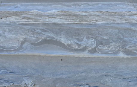
Volcanic ash disturbed by ancient earthquakes into wavy patterns, called seismites.
Deposits of ancient Lake Tecopa record these past tremors
Advocacy Updates
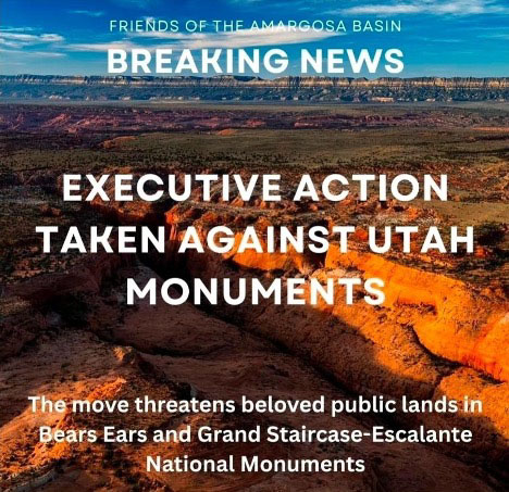
Much is happening in the world of public lands, and Friends of the Amargosa Basin staff and board are hard at work not only advocating for our own backyard, but our collective one alongside partners. Quick hits below:
- Executive action was taken earlier this month to substantially reduce the size of Bears Ears and Grand Staircase-Escalante National Monuments in Utah. This illegal action has resulted in broad public pushback. You can read more about it on our blog and take action.
- This month, the Department of the Interior also released a comment period to review management guidance for Wilderness Areas, Wilderness Study Areas, and Lands with Wilderness Characteristics. We anticipate that this effort is intended to weaken effective management of special areas under these designations. You can use this link to take action today!
- Friends of the Amargosa Basin has signed onto organizational letters for these issues, as well as the proposed revocation of protections surrounding Chaco Canyon in New Mexico.
- Here at home, FAB and partners have been working to build out support throughout Inyo and San Bernardino Counties, as well as at the state and federal levels, for protecting public lands in the Amargosa Basin!
Getting to Know FAB: Introducing Joe Kennedy
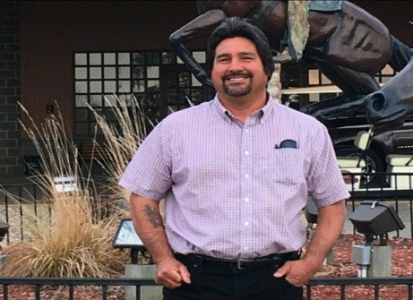
New FAB board member Joe Kennedy.
Welcome Joe to the FAB board! Joe grew up hunting, fishing, and hiking with his father within the Western Shoshone territory, known as Newe Sogobia. He has a long history of activism, as he and his family protested with others in Timbisha, commonly known as Death Valley, in 1996 in response to continued attempts by the National Park Service (NPS) to remove the Timbisha community members from Timbisha. The tribe gained federal recognition as a result of this movement and regained land with the passage of the Timbisha Shoshone Homeland Act.
Joe took a seat on the Western Shoshone National Council (WSNC) and the Western Shoshone Defense Project (WSDP) during the 2000s, as well as becoming chairman for the Timbisha Shoshone Tribe (TST).
He ran for the TST council on the premise that he would push for “Affected Status” with the Yucca Mountain Project, which was designated by the Nuclear Waste Policy Act of 1987 as the proposed deep geological repository storage facility within Yucca Mountain for spent nuclear fuel and other high-level radioactive waste within Newe Sogobia (Shoshone Earthmother). The laws of the United States denied tribes the ability to participate in the affected status process and was an uphill battle as these laws were racist and discriminatory. He was successful (with the support of the Timbisha elders) in this bid to gain Affected Status with the Yucca Mountain Project in 2007 and the TST was the first and only tribe to be able to acquire this status with the U.S. Department of Energy at that time.
During his time as Chairman for the TST and a Council Member on the WSNC, the Yumba Shoshone Tribe, Winnemucca Indian Colony, WSNC and the TST asked a United Nations Committee for the Elimination of Racial Discrimination (UNCERD) under its early warning and urgent Action Procedure to act on the ongoing human rights violations being committed by the United States of America against the Western Shoshone Nation. In 2006, a strongly worded CERD decision at its 67th session under its Early Warning and Urgent Action Procedure was rendered DECISION 1 (68).
Joe is also a board member on other organizations such as the WSDP, Great Basin Resource Watch (GBRW), Poohabah Healing Center, Native Community Action Council (NCAC), and the Tupippuh Project.
Food For the Body and Soul
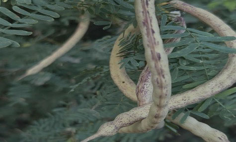
Honey mesquite beans ripening. Photo by Cameron Mayer.
MESQUITE PANCAKES
from Martha Darancou Aguirre of Rancho La Inmaculada
found on: https://www.desertusa.com/dusablog/
3/4C mesquite flour (honey mesquite flour can be bought locally at China Ranch)
1C flour (enriched, bleached, buckwheat)
1tsp baking powder
1/2 tsp salt
1 Tb sugar
1 tsp vanilla
2 eggs
1 to 2 C milk
Mix dry ingredients first. Add vanilla and eggs. Mix. Add milk until desired thickness is acquired. (The thinner the mix, the thinner the pancakes; the thicker the mix, the thicker the pancakes.) Spoon onto a hot griddle and flip when just beginning to bubble. Serve with butter and honey or better yet, prickly pear syrup. Makes 12 - 18 pancakes.
China Ranch in Tecopa is a good place to pick up some local mesquite flour!
A Little Desert Humor
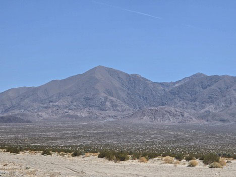
Alluvial fans of the Avawatz Mountains. Photo by Cameron Mayer.
Why is it so hot in the desert?
Because the alluvial fans are broken!
~ Phyllis Nefsky
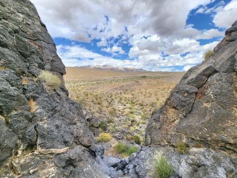
Looking out over a cliff in Kingston Wash. Photo by Cameron Mayer.
Stay in contact with FAB - follow us on social media, send this newsletter to your friends, family, and co-workers, and check out our website for information, events, updates, and more!
Did you know that you can find all of our old newsletters and a range of interesting blogs here?
Want to sport your very own Vole Fest and FAB gear? You can order t-shirts, sweatshirts, and more on our Bonfire store.