

Welcome to the Fall 2026 Edition of Amargosa Trails!
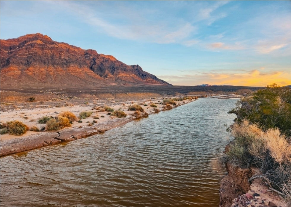
Eagle Mountain at sunset with the Amargosa River flowing in the foreground. Photo by Cameron Mayer.
LOOK AT THIS PHOTO! Ok, the water is seasonal, but even when not flowing, there are magical washes in the Amargosa, with plants and animals in their cool, protected microclimates. Local photographers like to take photos early in the AM and late in the afternoon in order to avoid the mid-day harsh glare of the sun and capture that “sky-blue pink” of the clouds.
When I was a girl, my mom would always say that her favorite color was sky-blue pink; we FIGURED she meant just this hue, but she wouldn’t confirm it. Besides, what else would you call the color of these clouds? And the mountains, instead of a pale silhouette as you would see in a 50-year-old photo, or one taken at 1:00 PM in full sun, you see vivid color gradations, creases, shoulders, horizontal elements, and dark rock inclusions.
When I first moved out West, I would see landscapes such as this and feel free, unbounded, called to drive to the farthest horizon and then go around the corner and keep going. I had my 4WD car, and as they say, it got us just deep enough in to get into trouble. I gaze at this photograph, and I see no limits. I see majesty. I smell the bitter dust. I sneeze with allergies because of the bitter brush, and despite the dust and allergies, I can take a huge breath of gratitude and peace. Gratitude for what Friends of the Amargosa Basin and the newly formed Tribes of the Eagle Mountain coalition are accomplishing (more on this later), and for what amazing support we are receiving. I feel gratitude for the Earth, which literally wants to provide. The busy hum of the city clutters our minds and spins, spins, spins.
This photo reminds us that the Earth can move that much more slowly, and that, even at 1 o'clock in the afternoon, those clouds and those rocks and those creatures are taking their siestas, only to poke back out again in the evening. Our job is to appreciate, witness, and steward. Thank you.
- Janet Foley, Board Member
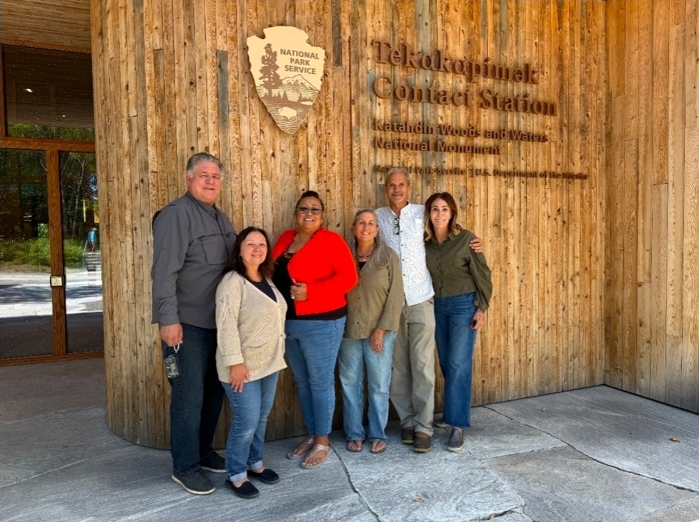
Visiting Katahdin Woods & Waters National Monument in Maine. Photo courtesy of Susan Sorrells.
The Amargosa, a Land Worth Protecting
By Susan Sorrells
There are few people who have experienced the Amargosa that are not enthralled by its beauty and are not inspired to return time and time again to continue to explore this region. The Amargosa is especially well known because a river runs through it, creating a string of oases across the desert supporting flora, fauna, and communities. But the Amargosa is also known for its other diverse landscapes, from sky islands to breathtaking viewscapes of five mountain ranges, and to intriguing clay hills that are the remnants of ancient lakes.
As the populations of Las Vegas and the Inland Empire began mushrooming, the Amargosa became an even more popular destination for outdoor recreation. At the same time, this fragile, beautiful region, like many other desert areas, began facing threats from hastily planned industrial solar projects and data centers. As a result, Friends of the Amargosa (FAB), a grassroots nonprofit, was formed to protect the Amargosa from these threats for many generations to come by achieving a land status change to a national monument. The campaign resonated with many people who showed support in a variety of ways.
Support for the monument continues to grow each year through the advocacy of FAB and many others. FAB’s website invites people from local communities and around the world to sign up as "Friends". Since the website was launched, this Friends network has grown quickly, spreading the word locally, regionally, and internationally. These special Friends also provide vital financial support to the FAB so that it can engage local communities and their political representatives to advocate for the monument campaign. These efforts have generated letters of support from Tribal Councils, elected officials, including the Inyo County Board of Supervisors, businesses, and community organizations in Shoshone, Tecopa, Lone Pine, Independence, and Bishop. The letters have been compiled in a support book. FAB Directors and Executive Director Cameron Mayer have also met with state and federal representatives to discuss the monument campaign and invite them to become partners
These special Friends are also invited by the FAB Board and staff to join curated tours of the Amargosa to thank them for their support, to enhance their knowledge of this special region, and to offer a day of enjoyment. In October, FAB sponsored such a tour that highlighted the world-class geology of the region, led by Dr Darrel Cowan, a retired professor from the University of Washington who has a second home in Shoshone and is a Board Director. The day was filled with knowledge, enjoyment, and gratitude on the part of FAB.
But the most important advance that FAB has made in the last year is that it has begun working with a Tribal Coalition called Tribes of the Eagle Mountain (TOTEM), which will lead the monument campaign. The Tribes that currently form the coalition are the Timbisha Shoshone, the Moapa Band, the Chemehuevi, and the Las Vegas Paiute. There are also other Tribal Nations in the region that are interested in becoming members. At the last Inter-tribal Coalition meeting, TOTEM chose Tecopah Amargosa as the name of the new proposed monument. When the monument is established, this coalition will co-manage the monument with the Bureau of Land Management. Mandi Campbell is the Inter-tribal Coordinator and is working with the TOTEM as the Tribal Nations begin interfacing with our partners. Mandi is a strong, wise leader who grew up in the Timbisha Shoshone Village in Death Valley and is profiled in this newsletter.
As Tribal Nations establish precedents for co-managing our public lands with the BLM across the United States, TOTEM is connecting with these Tribes involved in stewarding newly created monuments. Among them is the Penobscot Nation in Maine, whose members are active stewards of Katahdin Woods and Waters National Monument. In August, FAB board member Len Warren arranged a meeting in Maine that brought together Penobscot Nation members Jennifer Neptune and James Francis with Mandi Campbell, Len Warren, Molly Hansen, and Susan Sorrells. The visit was inspiring, and we look forward to welcoming Jennifer and James to the Amargosa this spring.
We are excited about the progress the Tecopah Amargosa National Monument is making, and we invite you to join us!
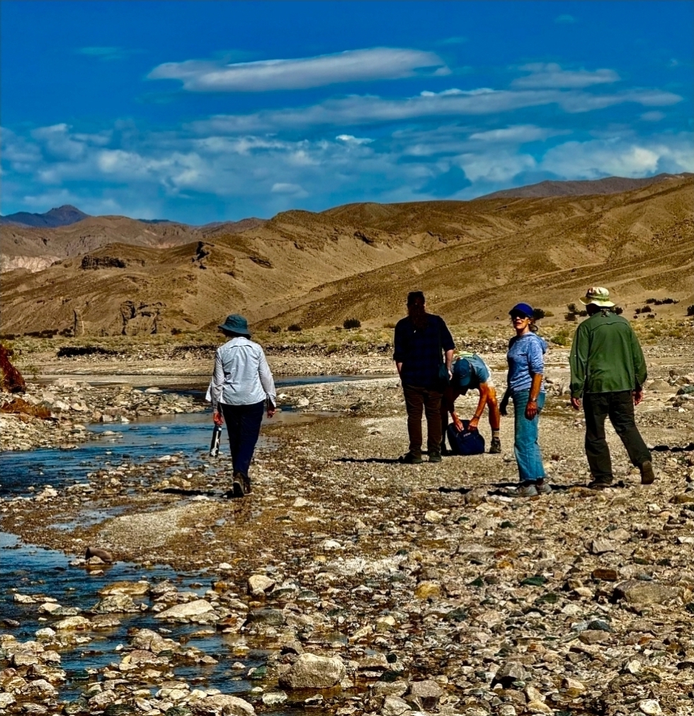
FAB supporters walk the Amargosa River at Sperry Wash. Photo from Susan Sorrells.
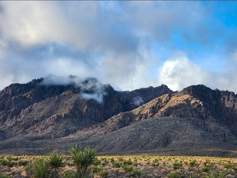
The Kingston Range after a storm. Photo by Cameron Mayer.
Ranges of the Proposed Tecopah Amargosa National Monument
By Cameron Mayer & Darrel Cowan
The proposed Tecopah Amargosa National Monument (formerly the proposed Amargosa Basin National Monument), within what is known as the Amargosa Basin in California, is home to wide-open valleys bounded by mountain range after mountain range. These isolated mountain ranges tower thousands of feet above the sweeping desert floor, lending themselves to the term “sky islands.” The sky islands of the Amargosa are remarkable due to their sheer diversity of values, including those related to geology, botany, wildlife, and the history of the area. Geographically, they are at the crossroads of the Mojave and Great Basin regions, with some historical climate-related influence from the Sonoran Desert and even the Rocky Mountains!
The lofty Kingston Range comprises two geologically different parts, both of which are important and distinctive features in the proposed monument area. Its notable rough and craggy topography results from the 12.5-million-year-old granite —the youngest in the monument area—underlying the entire central part of the range. In the northern Kingstons, a northwestward dipping stratigraphic section comprises all the units in the Proterozoic Pahrump Group. The oldest is the Crystal Spring Formation, estimated to be about 1.3 billion years old; the youngest, upholding the left skyline, is the Noonday Dolomite, about 550-600 million years old.
Two other notable elevated ranges, isolated from flanking basins, are the Nopah Range, with elevation topping out at 6345”, and the Resting Spring Range at 5351”. In both, Cambrian strata have been tilted along normal faults and are inclined about 45° eastward.
Plants and animals have difficulty crossing the sea of desert between mountain ranges, leading to isolated habitats and a higher-than-usual distribution of rare species or groupings of species. While not occupying sky island territory, Death Valley sage (Salvia funerea) and Utah agave (Agave utahensis) dot steep limestone slopes in the Nopah and Resting Spring ranges. Bobcats (Lynx rufus) and Desert bighorn sheep (Ovis canadensis nelsoni) water at scarce springs in the Kingston Range, while Gila monsters (Heloderma suspectum) and Parry’s nolina (Nolina parryi) lend a Sonoran Desert influence to the Amargosa. Great Basin sagebrush (Artemisia tridentata tridentata) can be found in the middle elevations of the Kingstons, while White fir trees (Abies concolor), more common in the Rocky Mountains, can be found up at the highest reaches. Higher elevations with cooler temperatures and more abundant and diverse vegetation provide refuge for larger mammals and migrating bird species.
The Nuwu/Nuwuvi (Southern Paiute/Chemehuevi) and Newe (Timbisha and Western Shoshone) peoples have had connections to the mountain ranges of the Amargosa for millennia, and those enduring connections continue to this day. Indigenous peoples have cared for these lands, the healing waters, plant medicines, and wildlife since the beginning. These tall mountain ranges have always been places of refuge, healing, and sources of sustaining resources.
With the more recent arrival of Euro-Americans, the history of mountain ranges in the Amargosa Basin became increasingly focused on extraction and settlement. Miners combed the ranges looking for precious minerals to strike it rich. Talc was mined in the Kingstons, Nopahs, and elsewhere. Lead and silver were discovered in the southern Nopahs, along with iron in the Kingstons. Springs were often modified or piped where needed, and a number of temporary settlements and permanent structures were built in now-forgotten canyons. The Old Spanish Trail passed through the southern Nopah Range, leading settlers through the area. The Kingston Range became a famous locale for hiding horses stolen from caravans along this route, lending the name “horse thief” to several local spots in the main canyon dividing the range.
Today, many of the ranges of the Amargosa are federally protected wilderness areas, where solitude and casual recreation are the predominant occupations. However, their connections to the rest of the landscape add significant meaning to their existence from a land management perspective. At Friends of the Amargosa Basin, we work every day to advocate for these special mountain ranges and the "connective tissue" that is the surrounding valleys so that the land as a whole can be protected and stewarded for generations to come.
Remember: These are remote mountains, and always be sure to check the weather, be aware of road conditions, and pack in case of emergencies before heading out to explore.
Ways to Support FAB
There are many ways to support our work to advocate for permanent protection of the Amargosa Basin’s vital public lands. We want to make sure that our Friends and supporters are well informed on all available options, many of which are detailed below. If you would like more information, please visit our website.
Want to support in other ways? Consider volunteering when opportunities are available, following us on social media, sending this newsletter to your friends, family, and co-workers, and ordering t-shirts, sweatshirts, and more on our Bonfire store.
- Online giving: Make a donation via our secure website portal.
- Send a check to:
Friends of the Amargosa Basin
P.O. Box 145
Shoshone, CA 92384
- Monthly giving: Please consider becoming a monthly sustaining donor. This ongoing, reliable financial support is especially important and identifies you as an amplifier of our efforts and goals.
- Qualified Charitable Distribution [QCD]: If you own a traditional Individual Retirement Account [IRA] or a traditional 401(k), you may need to take a Required Minimum Distribution [RMD] before December 31 of a calendar year. You can ask the administrator of your account to direct all or part of your RMD to Friends of the Amargosa Basin as a QCD. Contact the administrator of your account, who will assist you in completing the necessary forms. You will need:
-
- The name of the qualified charity: Friends of the Amargosa Basin
- Our tax ID/EIN: 85-2749230
- Our mailing address: P.O. Box 145, Shoshone, CA 92384
- Dollar amount of charitable donation
-
- Transfer of Appreciated Securities: Please contact our Executive Director for instructions about how to reach our designated brokerage firm. You will need:
-
- The name and stock symbol for the securities
- The number of shares to transfer
-
- Donor-advised fund [DAF]: If you have established a DAF with a national or community provider, such as Vanguard, Schwab, or TIAA, you can direct distributions to Friends of the Amargosa Basin. Contact your provider for instructions about distributions. Please plan with plenty of time to spare before the end of the year, as there can be delays!
- Estate giving: This can be arranged by contacting your estate attorney.
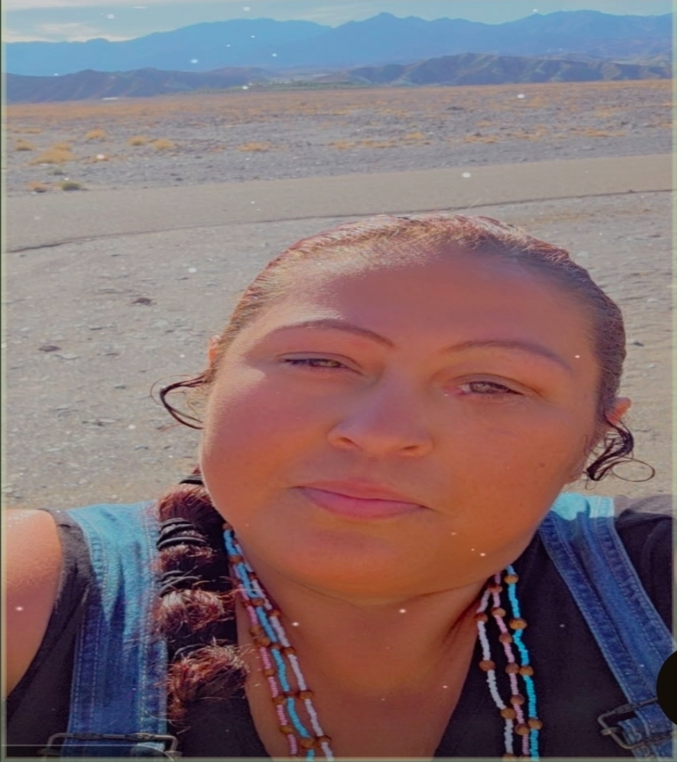
Photo courtesy of Mandi Campbell.
Meet Mandi - Coordinator for Tribes of the Eagle Mountain
My name is Mandi Campbell, and I am a member of the Timbisha Shoshone Tribe. My grandmother, Maime Boland, lived in one of the adobe houses in the village near Furnace Creek without electricity or indoor running water. My mother, Angie Boland, and my father lived in a small shack behind the adobe.
I attended school in Death Valley, one of the areas from which my family was relocated many years ago. I then went to high school in Shoshone, about an hour away. I am a mother to three children and four grandchildren.
I have previously worked several roles for the Timbisha Shoshone Tribe for about ten years. I first worked as the water quality specialist, funded by Section 106 (National Historic Preservation Act) and 319 (Clean Water Act) grants from the federal government. I then opened a taco shop in the Timbisha Village near Furnace Creek. However, the most rewarding experience was working as the Timbisha Shoshone Tribe’s Tribal Historic Preservation Officer (THPO). Being a THPO for the Tribe, I finally figured out my role in life.
I am currently the coalition coordinator for the Tribes of the Eagle Mountain, or TOTEM. This coming together of Tribal Nations is a powerful step towards protecting Mother Earth and Father Sky. We are taking an evolving leadership role in the Tecopah Amargosa National Monument campaign. In the meantime, we are working with local and regional partners to advocate on the ground and move this proposal forward. An important part of this is to continue to fight for tribal sovereignty and rights on our traditional lands.
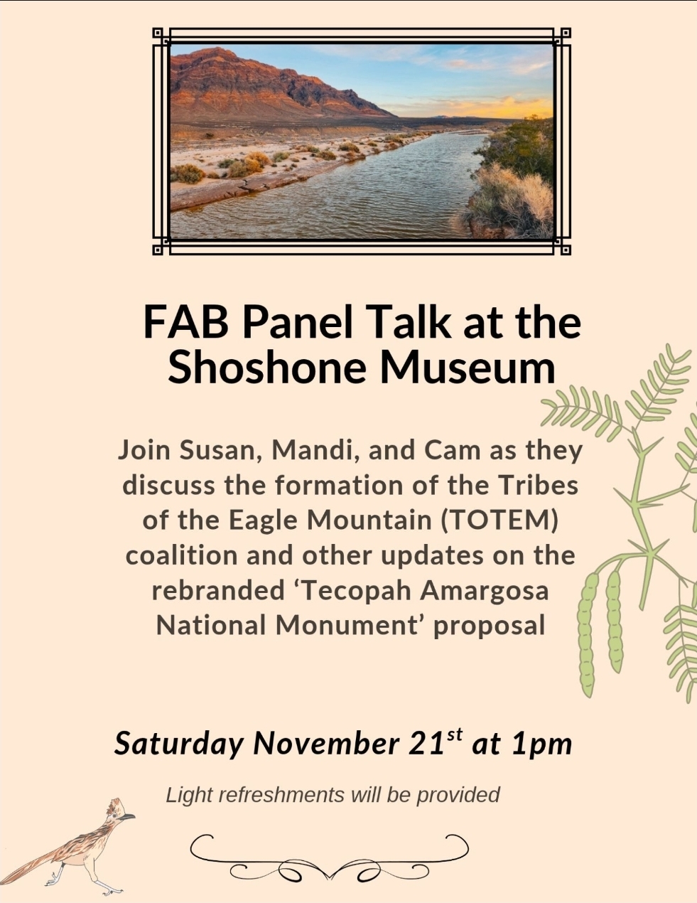
Saturday November 21st at 1pm @ the Shoshone Museum
Upcoming Events
With the weather cooling down, a lot is coming up in the Amargosa. Below are some events we’re hosting and some we’re participating in as a part of the community. Come on out!
Weird Tales Festival -
November 13th & 14th in Shoshone & Tecopa, CA
This is an event put on by our local fire protection district, and FAB will be participating. Enjoy a Friday movie premiere at the Flower Building in Shoshone and a Saturday full of art, film, and activities at the community center in Tecopa. The theme is “Weird Tales”, so be prepared to immerse yourself in all things weird in the Mojave Desert! Check out the event website here.
FAB Talk @ the Shoshone Museum -
November 21st at 1 pm in Shoshone, CA
Swing by the Shoshone Museum on Saturday, November 21st at 1 pm for live updates on all things FAB, the formation of Tribes of the Eagle Mountain (TOTEM), and updates on the effort to protect the Amargosa Basin for generations to come through a national monument designation. Light refreshments will be served.
Screening of “We Are Still Here” Documentary -
December 19th at 1 pm, in the Shoshone Flower Building.
Join us and our friends with the Timbisha Shoshone Tribe and the Shoshone Museum for a pre-holiday showing of this incredible documentary describing the Timbisha Shoshone Tribe and their resilience in the face of modern-day opportunities and challenges. Includes scenes with elders, Lake Manly, and the 2026 superbloom in Death Valley.
Stay tuned for more volunteer opportunities in the works, and our spring suite of events coming up.
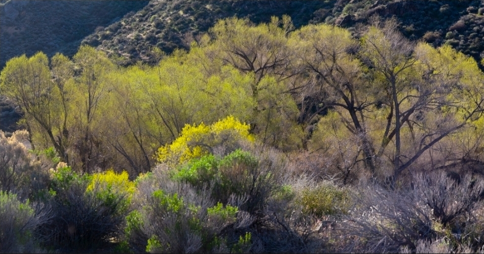
Horse Thief spring in the Kingston Range. Photo by Bob Wick.
Last Words
By Janet Foley
A little desert humor:
What do you call a penguin in the Amargosa?
(Well, first you call the Bird man of the Amargosa, FAB board member Len Warren, because he’ll want to know!)
But the real answer is: lost!
Desert Recipes: Sopa de Nopales (prickly pear fruit)
Cut about 2 pounds of nopales into cubes (after their spines have been removed!). Up here in Nor Cal, I can find fresh nopales in Grocery Outlet or in Mexican markets.
Cook them in boiling water with salt for 20 minutes. Remove from heat, drain, and rinse with cold water.
Chop 4 tomatoes, half an onion, and 2 cloves of garlic or put into a blender. Optionally, add a fresh spicy chile.
Sauté for 5 minutes. Add Mexican oregano, 3 c of vegetable or chicken broth, then the nopales, and cook at low heat for 15 minutes. Season to taste with salt and pepper.
If you’d like, top before serving with fresh avocado, cilantro, crema, and lime. Ideally, serve with homemade warm tortillas!